Features GIS SHedit
With the GIS SHedit app, authorized users can capture geodata of specific topics on the go and on-site.Welcome to the geographical information platform of the canton of Schaffhausen.
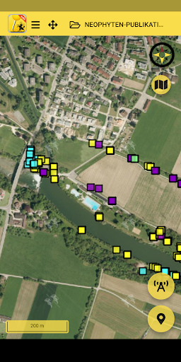
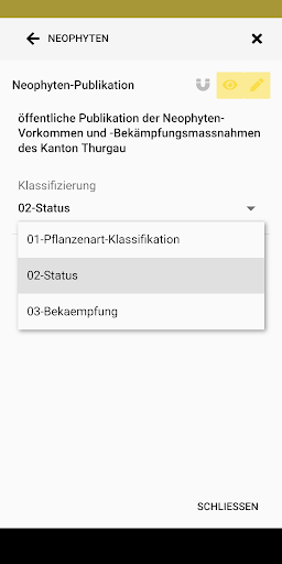
GIS SH is the abbreviation for "Geographical Information System Schaffhausen" and offers you two-dimensional views with georeferenced and interactive maps.Edit stands for editing, so that new geodata can be recorded and changed.In order to be able to record geodata for a specific topic, the user needs a user account which he can apply to the Office for Geoinformation.Hints:==========* The maps and geodata offered are limited to the Canton of Schaffhausen* Only geodata in the canton can be recorded* A mobile data connection is required to use the GIS SHedit app.
There may be feesFeatures:==========* Acquisition and processing of point, line and surface geometries, including information on them* Capture photos for each geometry directly in the app* Measure distance and area* Different background map views: orthophoto, open street map* Search for locations* GPS localization* Offline useThis app is based on Sabretooth from Kaden & Partner AG https://www.sabretooth.ch/
Social Features
Connect and share with friends and the community.
Camera Features
Advanced camera features with editing capabilities.
Fitness Tracking
Track your workouts and monitor your health metrics.
See the GIS SHedit in Action

Get the App Today
Available for Android 8.0 and above